I remember when I first heard we were moving to Singapore, we read many of the travel books, trying to see what was here, what to fill our spare time with. Having grown up with our holidays involving predominately walking in the picturesque national parks of the UK, I was keen to visit the Southern Ridges and have indeed now been numerous times in different directions, start and finish points and in all weathers. OK it may not be the craggy mountains and deep valleys I'm used to, but on this tiny island it's a small haven and in 30 + degree heat the short hills certainly make you puff!!
As I mentioned there are several start points but for the purpose of this post I shall start in the west and finish walking down the Marang trail ending at Harbour Front MRT.

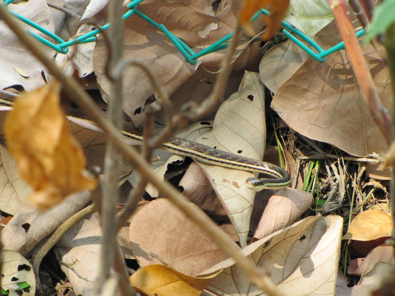
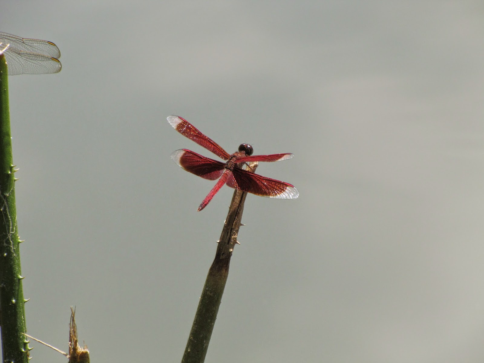
The southern ridges are, as stated, a coast hill ridge that runs 10km along the southern edge of Singapore and are split into different parks and walkways. In the west lies Kent Ridge park and although some guides say you can start the walk at West Coast Park through Clementi Woods and up into Kent Ridge, a major portion of this is along the road, therefore the general consensus is to start (or finish) at Kent Ridge. Starting positions can be from Haw Par Villa MRT, walking up a steep winding road to the top of the park or alternatively Kent Ridge MRT, where a short walk through the Science Park brings you into the base of the park by two lakes filled with wildlife. Mynah birds, monitor lizards, kingfishers, turtles and dozen of different species of dragon and damsel fly are just a few that can be spotted here.


Up to the top of Kent Ridge and you can take a breather, looking out of the sea at the new vast harbour being built, each time we visit more and more land has been "built" and the southern coast lives up to its industrial tag.

From Kent Ridge you must take the 280 metre long Canopy Walk, a raised wooden walkway above the forest that gives views of Singapore and in the distance sits Canterbury road area with many "back and whites' (Colonial houses) Each time I come along here I'm greeted by this massive flying black beetle, which I've affectionately named the "flying tank", how it takes off and stays in the air I don't know, it really doesn't look like it was built to fly. At the end of the walk sits Reflections at Bukit Chandu. A small museum housed in another old black and white. Entrance is just $2 for non Singaporeans. Singaporeans and PRs get in free. The museum is all about the Singapore 1st and 2nd Malay Regiment and the defence of Bukit Chandu and Pasir Panjang. The terrible bombing and battle fought by the 2nd Battalion on 13 Feb 1942, just 2 days before the British surrendered Singapore. A small but interesting place, well worth a visit, especially if you have older parents and relatives visiting. A kindly uncle always seems to be on hand, eager to show you everything.


From Bukit Chandu and the Canopy Walk we walk down a zig zag path to the bottom of the ridge line into Hort Park, a 23 hectare park containing what is described as a "one-stop gardening hub", specializing in education and research. It was opened in December 2007. Refreshments are available here and many families bring their children to enjoy the individual Gardens that are in show here, you can even get married here! Walking out of Hort park you pass through the Floral Walk and on most visits you will be able to see many sunbirds.


You now come to the busy Alexander road and Alexander Arch bridge, where if you wish you can turn right and walk down the road to end your walk at Labrador MRT or indeed pass down Berlayer Creek and explore Labrador Park nature reserve and back along Keppel Bay (another individual walk we've completed several times) However, we're walking the length of the Ridges today so, we cross over Alexander arch "Gateway to Nature" a large 80 metre metal bridge designed to represent an open leaf, its lit at night between 19:00 - 0:00 with changing coloured bulbs.


The bridge takes you on the metal raised walkways of the Forest Walk that zig zag over the forest and up to Telok Blangah Hill. As you walk above the treetops of "Adinandra Belukar" secondary rainforest, we have spotted laughing thrushes, drongos, Koels, Golden Orioles, other birds, squirrels. You will again pass by a row of black and white colonial houses.


At the end of the walkway on Telok Blangah hill, take the road right, then left up a short steep stretch, you have now arrived on top of the Terrace Garden, with stunning views over the city. This is Victorian style ballustraded terrace garden, planted with vibrant coloured bougainvilleas.
![]()
![]()
![]()
From here it's a short stroll to the architecturally stunning Henderson Waves Bridge. The 274 metre long bridge links Telok Blangah hill to Mount Faber and sits 36 metres above ground, making it the highest pedestrian bridge in Singapore.
![]()
![]()
![]()
You have now reached Mt Faber park, with various pathways through the forest to the top, where it says you can see a 360 degree view of Singapore (perhaps if you cut some trees down) having said that still some good views and spot the small merlion that's there.


From here it's a short stroll to the architecturally stunning Henderson Waves Bridge. The 274 metre long bridge links Telok Blangah hill to Mount Faber and sits 36 metres above ground, making it the highest pedestrian bridge in Singapore.


You have now reached Mt Faber park, with various pathways through the forest to the top, where it says you can see a 360 degree view of Singapore (perhaps if you cut some trees down) having said that still some good views and spot the small merlion that's there.


A little further on and you reach Jewel Box where you can take the cable car across to Sentosa. A small number of shops and cafés are here, if you need refreshment, before the last stretch of the walk, down off the ridge via the Marang Trail. It's down hill all the way here, on mainly wooden steps, passing by a few more black and whites and where we've spotted several golden orb spiders.
![]()
![]()
![]()
![]()
![]()
At the bottom as you come out of the trees and with Harbour Front MRT in front, look carefully to your left and you should be able to spot a Malay tomb and some graves stones, some dating back to 1866. There was once a Malay Kampong here called Kampong Marang.


At the bottom as you come out of the trees and with Harbour Front MRT in front, look carefully to your left and you should be able to spot a Malay tomb and some graves stones, some dating back to 1866. There was once a Malay Kampong here called Kampong Marang.


As I said this is just one way to enjoy and walk the ridges, but there are various computations that can be explored. Take a wander and enjoy, OK it's not wild, barren and at no time do you forget you're in Singapore, as everything is manicured and well kept, but it's still good to get out, see some wildlife and stretch those legs :)
![]()
![]()
![]()